
Situated between Brevard and Hendersonville, NC, DuPont State Recreational Forest is one of the most famous mountain biking destinations in the southeast. And it’s little wonder why.

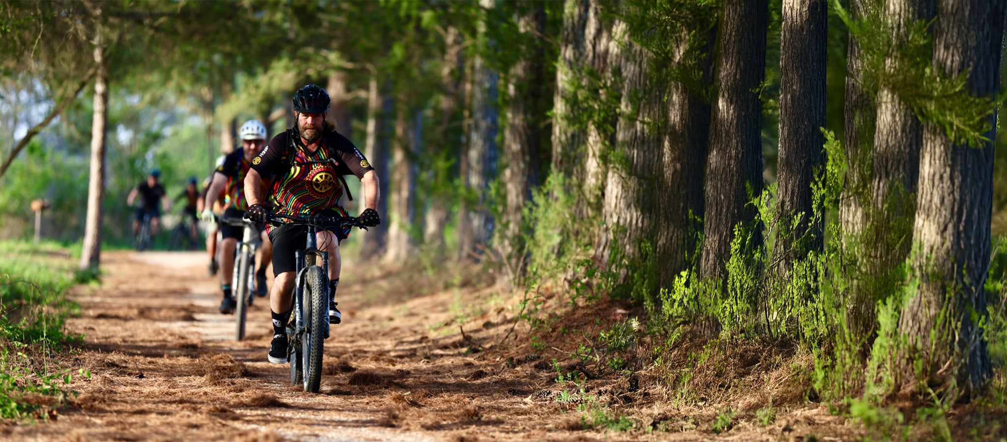
With about 80 miles of trails, there’s something for everyone here: rushing waterfalls, granite outcroppings, gnarly singletrack, and a hearty helping of flowy descents.
In this article, we dish the deets on DuPont—a place near and dear to our hearts.
An Overview of DuPont State Forest
Designated as North Carolina’s first recreational forest, DuPont is a 10,400-acre oasis for outdoor enthusiasts. Each year, more than one million visitors flock to this sweet spot to admire rushing waterfalls, swim in cold mountain water, hike to sun-dappled peaks, and shred sweet singletrack.
No matter your activity of choice, you’ll have plenty to look at. This forest is so beautiful that it served as a backdrop for the 2012 blockbuster The Hunger Games. But not too long ago, DuPont State Forest was on the verge of ruin.
Before this land was a protected area, it was owned by a chemical company called the DuPont Corporation. When DuPont closed its doors, the land changed hands several times before being bid on by a residential developer in the 1990s.
This man hoped to build at least 100 upscale vacation homes. But locals weren’t having any of it. They rallied support and pushed back, launching a campaign that would eventually safeguard the forest from any future development.
3 Best Mountain Bike Trails in DuPont State Forest
Thanks to that grassroots movement, DuPont is now a mountain bikers mecca. But with more than 80 miles of doubletrack and singletrack to choose from, it can be hard to know where to start.
To help you plan your next excursion, we have rounded up three of the best mountain bike trails in DuPont State Forest. So, prepare to pedal. It’s gonna be a wild ride.
For Beginners: Ridgeline Loop
Looking for flow? If so, look no further than Ridgeline Loop. This quick, six-mile trail is notorious for its fast but approachable descent.

Directions: Start at the Lake Imaging parking lot on Staton Road. Follow the gravel doubletrack and then take a left onto Jim Branch Trail where you’ll be greeted by a pucker-worthy rock garden.
After navigating the gnar, the trail offers a moderate climb to a saddle. Catch your breath and then take Isaac Heath on the right. This trail will dump you onto Buck Forest Road. Ride Buck Forest before taking a right onto Thomas Cemetery Road.
Follow Thomas Cemetery Road until it changes to White Pine Trail. From White Pine, drop onto Hooker Creek Trail, a techy descent with lots of ruts and rocks. Hooker Creek will funnel you to the main event: Ridgeline.
Fast and flowy with tons of sweet berms, Ridgeline will leave you smiling from ear-to-ear.
View the DuPont Forest Mountain Bike Trail Map
For Thrillseekers: Mine Mountain Trail
If you need to burn some calories fast, plan a trip to Mine Mountain Trail. Right out of the gate, you’ll face a steep, lung-bursting climb. But for your efforts, you’ll be rewarded with a flowy, lightly technical descent.

Directions: Starting at the Fawn Lake Access Area, take a left onto Fawn Lake Road. Follow the gravel doubletrack and then take your first left onto Mine Mountain Trail. After some huffing and puffing, drop your seat and prepare for a friggin’ fast descent. Speeds can flirt with 30 miles per hour on this section.
All in all, Mine Mountain Trail is a little shy of 1.5 miles. To lengthen your adventure, take Conservation Road to the airstrip. Though now defunct, this 2,800-foot-long airstrip was used in the 1960s when the area served as a summer camp. Today, the runway is a fun place to take photos and nab swoon-worthy views of Mt. Pisgah.
If you still have some energy, take Lake Julia Road down to Lake Julia: a 99-acre reservoir with plenty of spots for a picnic.
View the DuPont Mountain Bike Trail Map
For Gnar Enthusiasts: Big Rock Loop
By far one of the most interesting routes in DuPont, the six-mile Big Rock Loop takes riders along Little River and then up to Cedar Rock Mountain, a bald granite dome with 360-degree views of the valley below.

Directions: Park in the Corn Mill Shoals Access Area and then cross Cascade Lake Road. Keep right on Corn Mill Shoals Trail and continue until you reach a trail junction. Stay right on Burnt Mountain Trail and prepare for a fairly grueling uphill slog.
From there, you’ll briefly return to Corn Mill Shoals Trail before turning right onto Little River Trail. (Since this trail runs along Little River, it gets pretty muddy during the summer. For good measure, always be sure to ride with your MTB mudguard.)
Right before Little River deadends, hang a left onto Cedar Rock Trail for another lung-bursting climb. This trail will lead you to the pièce de résistance: Big Rock Trail. A true black diamond, this DuPont State Forest bike trail meanders down a slippery granite face. Take it slow or risk going over the bars.
View the DuPont State Forest Trail Map PDF
DuPont State Forest MTB Trail Rules
When riding the DuPont State Forest mountain bike trails, there are a few guidelines to keep in mind.
- Only ride on established trails. We highly recommend blazing your own path—proverbially at least. But when it comes to the DuPont State Forest bike trails, be sure to stay on route.
- Keep Fido leashed. Though trail pups are awesome, you need to keep Fido on a leash when exploring DuPont.
- Avoid the hiker-only trails. Almost all of the trails in DuPont are multi-use. However, some short segments leading to waterfalls are closed to bikes.
- Yield to hikers and horses. To avoid a dangerous collision, always yield to hikers and equestrians. Also, be sure to communicate and ask permission to pass when you overtake another user.
- Maintain a safe speed. Some of the best MTB trails in DuPont State Forest are fast. Like, really fast. And though we certainly recommend cutting loose and getting wild, keep in mind that all trails are two-way.
- Leave no trace. Respect the forest and be sure to pack out all of your trash.
Can I Ride My Bike to Hooker Falls?
Located off Staton Road, Hooker Falls is one of the best swimming holes in all of DuPont State Forest. The water of the Little River is cold and refreshing, but mellow enough for kiddos to have a great time too.
If you’ve spent the day huffing and puffing on your hardtail, there’s nothing better than a dip in Hooker Falls. However, we don’t recommend that mountain bikers ride to Hooker Falls.
Why? Because the short stretch of doubletrack leading to the waterfall is simply too congested. You’ll spend the entire mile slamming on your brakes, dodging families carting floaties and coolers. It’s not a fun time—trust us.
If you want to cool off after shredding in DuPont State Forest, we instead recommend Fawn Lake. Located off Fawn Lake Road, this pristine reservoir is less crowded than Hooker Falls. Plus, there’s a gazebo for lounging.
You can easily add a Fawn Lake swim onto your itinerary if you’re riding Mine Mountain Trail (see above).
Gear We Recommend for Your Ride
At Cognative MTB, we want to help you have a good time outside. With this in mind, we have curated a list of must-have gear for your next trip to DuPont State Forest.

Since the only public water fountains in DuPont are at the Aleen Steinberg Visitor’s Center, you need to bring adequate H20. Fortunately, you can stay hydrated in style with these sweet topographic water bottles.

The DuPont State Forest mountain bike trails can get pretty gnarly after a heavy rain. To keep your bike (and butt) clean, give these MTB mudguards a try.

Made from breathable, antimicrobial fabric, these MTB jerseys will keep you feeling and smelling good after a long day riding the best MTB trails in DuPont.
4. Men's MTB Gear & Women's MTB Gear
Looking for more mountain bike gear suggestions?! Head to our website, where you can shop by specific collection.
DuPont State Forest FAQs
What town is DuPont State Forest in?
DuPont State Forest is located in Cedar Mountain, a tiny unincorporated community about 20 miles south of Hendersonville, NC, and 10 miles south of Brevard, NC.
When is DuPont State Forest open?
DuPont State Forest is open year-round from 5 a.m. to 10 p.m. However, stretches of singletrack are occasionally closed because of inclement weather. For updates regarding closures, follow the Friends of DuPont Forest Facebook and Instagram pages.
Is DuPont State Forest free?
Fortunately for mountain biking enthusiasts, it’s completely free to visit DuPont State Forest. But please consider making a donation to Friends of DuPont Forest, the folks helping maintain and protect this beloved trail system.
Where can I find a DuPont mountain bike trail map?
Since the cell phone service is spotty in DuPont, we recommend downloading your route ahead of time on Trailforks. If you’re more of an analog type, you can buy a DuPont State Forest paper map.
Are there bathrooms in DuPont State Forest?
Yes. There are public restrooms located near the Aleen Steinberg Visitor’s Center at the High Falls Access Area. There are also porta-potties at many of the trailheads.
Is camping allowed in DuPont State Forest?
There is no camping allowed in DuPont State Forest. However, there are plenty of private camping accommodations nearby.
For more information on the forest, visit the official website of DuPont State Recreational Forest.